


ps blavet

psester
User
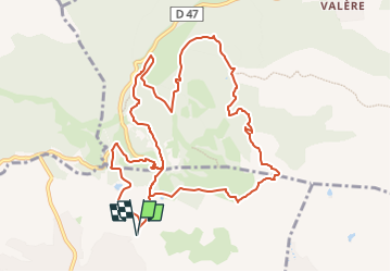

Length
12.8 km

Max alt
334 m

Uphill gradient
423 m
Km-Effort
18.4 km

Min alt
91 m

Downhill gradient
423 m
Boucle
Yes
Creation date :
2024-03-29 07:41:53.452
Updated on :
2024-04-08 17:02:38.325
4h11
Difficulty : Difficult

FREE GPS app for hiking
 SityTrail
IGN / Geographical institutes
SityTrail Plus
The world is yours!
About
Trail Walking of 12.8 km to be discovered at Provence-Alpes-Côte d'Azur, Var, Roquebrune-sur-Argens. This trail is proposed by psester.
Description
Rando variée, découverte des grottes préhistoriques de la Bouverie, chemin très agréable le long du Blavet, attention aux gués après la pluie
Positioning
Country:
France
Region :
Provence-Alpes-Côte d'Azur
Department/Province :
Var
Municipality :
Roquebrune-sur-Argens
Location:
Unknown
Start:(Dec)
Start:(UTM)
310218 ; 4819870 (32T) N.
Comments