


pain de sucre coquin

Titinechris
User
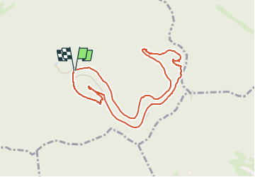

Length
9.1 km

Max alt
823 m

Uphill gradient
410 m
Km-Effort
14.6 km

Min alt
465 m

Downhill gradient
412 m
Boucle
Yes
Creation date :
2024-03-31 07:14:54.964
Updated on :
2024-03-31 07:16:24.399
3h18
Difficulty : Difficult

FREE GPS app for hiking
 SityTrail
IGN / Geographical institutes
SityTrail Plus
The world is yours!
About
Trail Walking of 9.1 km to be discovered at Grand Est, Vosges, Celles-sur-Plaine. This trail is proposed by Titinechris.
Positioning
Country:
France
Region :
Grand Est
Department/Province :
Vosges
Municipality :
Celles-sur-Plaine
Location:
Unknown
Start:(Dec)
Start:(UTM)
351057 ; 5368444 (32U) N.
Comments