


combe de la fare colombier

brandy
User
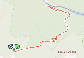

Length
7.2 km

Max alt
302 m

Uphill gradient
267 m
Km-Effort
10.8 km

Min alt
62 m

Downhill gradient
267 m
Boucle
Yes
Creation date :
2024-04-05 19:15:25.089
Updated on :
2024-04-05 19:16:17.459
2h27
Difficulty : Medium

FREE GPS app for hiking
 SityTrail
IGN / Geographical institutes
SityTrail Plus
The world is yours!
About
Trail Walking of 7.2 km to be discovered at Auvergne-Rhône-Alpes, Ardèche, Labastide-de-Virac. This trail is proposed by brandy.
Description
pas simple
Positioning
Country:
France
Region :
Auvergne-Rhône-Alpes
Department/Province :
Ardèche
Municipality :
Labastide-de-Virac
Location:
Unknown
Start:(Dec)
Start:(UTM)
612663 ; 4912401 (31T) N.
Comments