


Sainte-Victoire_28k750d

ja.13061965
User
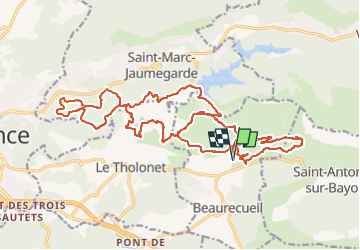

Length
28 km

Max alt
451 m

Uphill gradient
750 m
Km-Effort
38 km

Min alt
228 m

Downhill gradient
749 m
Boucle
Yes
Creation date :
2024-04-06 06:28:49.361
Updated on :
2024-04-09 12:01:51.063
4h22
Difficulty : Medium

FREE GPS app for hiking
 SityTrail
IGN / Geographical institutes
SityTrail Plus
The world is yours!
About
Trail Mountain bike of 28 km to be discovered at Provence-Alpes-Côte d'Azur, Bouches-du-Rhône, Beaurecueil. This trail is proposed by ja.13061965.
Description
Effectuée le 6 avril 2024, variante sans passer par le lit de la rivière interdit...
Positioning
Country:
France
Region :
Provence-Alpes-Côte d'Azur
Department/Province :
Bouches-du-Rhône
Municipality :
Beaurecueil
Location:
Unknown
Start:(Dec)
Start:(UTM)
705875 ; 4822108 (31T) N.
Comments