


Le mont vinaigre

Jean Raynal
User
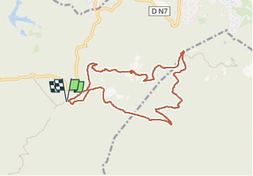

Length
9.3 km

Max alt
600 m

Uphill gradient
385 m
Km-Effort
14.4 km

Min alt
235 m

Downhill gradient
381 m
Boucle
Yes
Creation date :
2024-04-08 06:30:27.726
Updated on :
2024-04-08 09:19:00.653
2h47
Difficulty : Medium

FREE GPS app for hiking
 SityTrail
IGN / Geographical institutes
SityTrail Plus
The world is yours!
About
Trail Walking of 9.3 km to be discovered at Provence-Alpes-Côte d'Azur, Var, Fréjus. This trail is proposed by Jean Raynal.
Positioning
Country:
France
Region :
Provence-Alpes-Côte d'Azur
Department/Province :
Var
Municipality :
Fréjus
Location:
Unknown
Start:(Dec)
Start:(UTM)
322530 ; 4818382 (32T) N.
Comments