


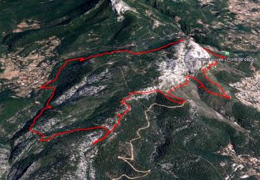
11.8 km | 19.3 km-effort

Que du Bonheur!!


FREE GPS app for hiking
 SityTrail
IGN / Geographical institutes
SityTrail World
The world is yours!
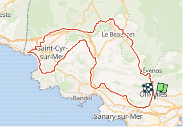
Trail Cycle of 53 km to be discovered at Provence-Alpes-Côte d'Azur, Var, Ollioules. This trail is proposed by Immortelles Vélo 2024.
Ollioules, Rte de Sanary, Ch Coletta, Ch Tourelle, Ch Chapelle Ste Trinide, Ch Ste Trinide, Rte du Beausset, Rte de Bandol, Ch Argile, Ch St Come, Don Bosco, La Madrague, St Cyr Port, D559 (verc St Cyr Centre), Av du Littoral, Ch Roumanieu, Ch de la Bourrasque, Ch des Pradeaux, Ch Jas David, Ch Barbarie, Ch St Antoine, D82 (le long de l'autoroute), Rte Grand Vallat, Le Brûlat, Ch Faremberts, Le Beausset, Ch Pignet, Ch Ste Brigitte, RN8, Les Gorges, Ollioules.
Walking
Walking
Walking

Walking
Walking
Walking

Walking
Walking
Walking