


Le combeynot

CABERMAT
User
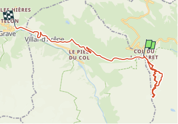

Length
17.4 km

Max alt
3002 m

Uphill gradient
989 m
Km-Effort
32 km

Min alt
1492 m

Downhill gradient
1543 m
Boucle
No
Creation date :
2024-04-12 06:26:56.855
Updated on :
2024-04-12 12:42:21.926
6h14
Difficulty : Very easy

FREE GPS app for hiking
 SityTrail
IGN / Geographical institutes
SityTrail Plus
The world is yours!
About
Trail Touring skiing of 17.4 km to be discovered at Provence-Alpes-Côte d'Azur, Hautes-Alpes, Villar-d'Arêne. This trail is proposed by CABERMAT.
Positioning
Country:
France
Region :
Provence-Alpes-Côte d'Azur
Department/Province :
Hautes-Alpes
Municipality :
Villar-d'Arêne
Location:
Unknown
Start:(Dec)
Start:(UTM)
295580 ; 4990081 (32T) N.
Comments