


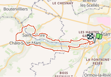
T-JG-A53s-Vallée-de-la-Chalouette

Jack-94
User

Length
18.6 km

Max alt
147 m

Uphill gradient
357 m
Km-Effort
23 km

Min alt
77 m

Downhill gradient
357 m
Boucle
Yes
Creation date :
2024-04-13 07:45:46.92
Updated on :
2024-04-16 10:10:41.677
6h16
Difficulty : Very difficult

FREE GPS app for hiking
 SityTrail
IGN / Geographical institutes
SityTrail Plus
The world is yours!
About
Trail Walking of 18.6 km to be discovered at Ile-de-France, Essonne, Étampes. This trail is proposed by Jack-94.
Positioning
Country:
France
Region :
Ile-de-France
Department/Province :
Essonne
Municipality :
Étampes
Location:
Unknown
Start:(Dec)
Start:(UTM)
436702 ; 5364199 (31U) N.
Comments