


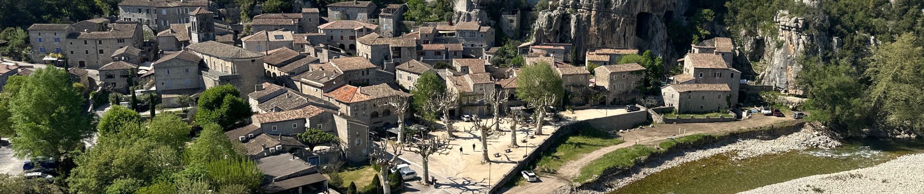
Ruoms, Labeaume

alinetpierre
User
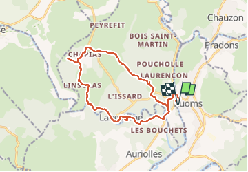

Length
17.5 km

Max alt
279 m

Uphill gradient
415 m
Km-Effort
23 km

Min alt
105 m

Downhill gradient
415 m
Boucle
Yes
Creation date :
2024-04-14 07:27:06.0
Updated on :
2024-04-14 15:08:23.204

FREE GPS app for hiking
 SityTrail
IGN / Geographical institutes
SityTrail Plus
The world is yours!
About
Trail of 17.5 km to be discovered at Auvergne-Rhône-Alpes, Ardèche, Ruoms. This trail is proposed by alinetpierre.
Description
Très belle randonnée réalisée en début mai,
Photos


Positioning
Country:
France
Region :
Auvergne-Rhône-Alpes
Department/Province :
Ardèche
Municipality :
Ruoms
Location:
Unknown
Start:(Dec)
Start:(UTM)
606287 ; 4923097 (31T) N.
Comments