


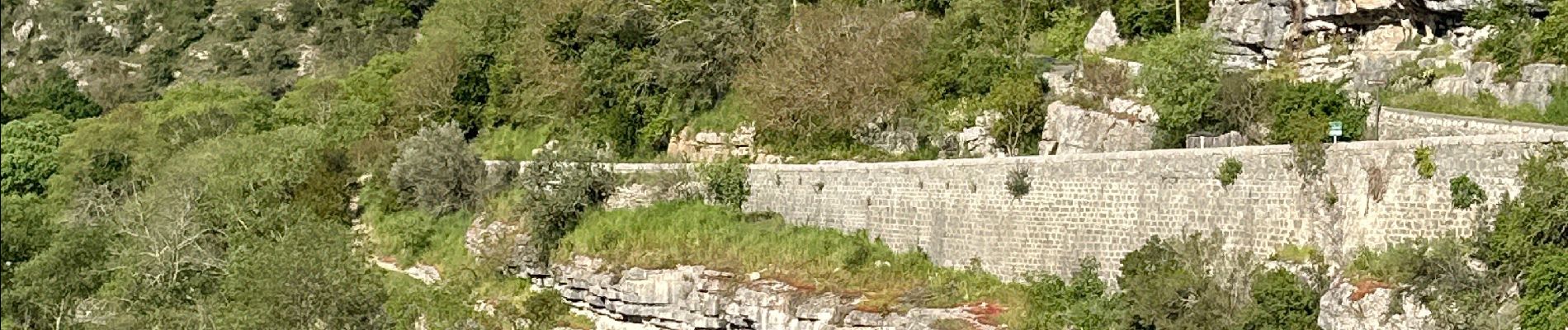
Balazuc la tour de Jeanne le Viel Audon

alinetpierre
User
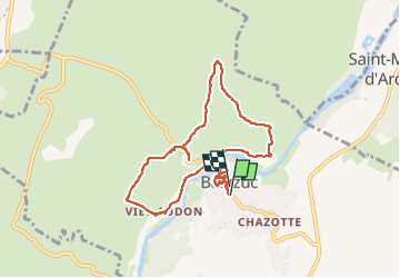

Length
8.5 km

Max alt
233 m

Uphill gradient
285 m
Km-Effort
12.3 km

Min alt
129 m

Downhill gradient
275 m
Boucle
Yes
Creation date :
2024-04-16 07:19:39.0
Updated on :
2024-04-16 10:31:13.914

FREE GPS app for hiking
 SityTrail
IGN / Geographical institutes
SityTrail Plus
The world is yours!
About
Trail of 8.5 km to be discovered at Auvergne-Rhône-Alpes, Ardèche, Balazuc. This trail is proposed by alinetpierre.
Description
Superbe boucle, reconnaissance amicale ca
Photos


Positioning
Country:
France
Region :
Auvergne-Rhône-Alpes
Department/Province :
Ardèche
Municipality :
Balazuc
Location:
Unknown
Start:(Dec)
Start:(UTM)
609139 ; 4929186 (31T) N.
Comments