


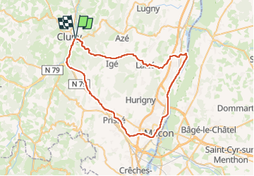
de cluny a cluny par la voie bleu

jpfrobert
User

Length
61 km

Max alt
510 m

Uphill gradient
886 m
Km-Effort
72 km

Min alt
166 m

Downhill gradient
889 m
Boucle
Yes
Creation date :
2024-04-17 10:06:11.109
Updated on :
2024-04-17 10:07:19.011
2h00
Difficulty : Medium

FREE GPS app for hiking
 SityTrail
IGN / Geographical institutes
SityTrail Plus
The world is yours!
About
Trail Electric bike of 61 km to be discovered at Bourgogne-Franche-Comté, Saône-et-Loire, Cluny. This trail is proposed by jpfrobert.
Positioning
Country:
France
Region :
Bourgogne-Franche-Comté
Department/Province :
Saône-et-Loire
Municipality :
Cluny
Location:
Unknown
Start:(Dec)
Start:(UTM)
628360 ; 5143292 (31T) N.
Comments