


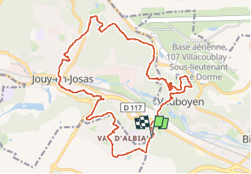
2024-04-17 Rando Jouy en Josas

jchezlemas
User

Length
12.2 km

Max alt
178 m

Uphill gradient
267 m
Km-Effort
15.8 km

Min alt
79 m

Downhill gradient
272 m
Boucle
Yes
Creation date :
2024-04-17 07:09:49.429
Updated on :
2024-04-17 16:56:50.291
3h04
Difficulty : Easy

FREE GPS app for hiking
 SityTrail
IGN / Geographical institutes
SityTrail Plus
The world is yours!
About
Trail Walking of 12.2 km to be discovered at Ile-de-France, Yvelines, Jouy-en-Josas. This trail is proposed by jchezlemas.
Positioning
Country:
France
Region :
Ile-de-France
Department/Province :
Yvelines
Municipality :
Jouy-en-Josas
Location:
Unknown
Start:(Dec)
Start:(UTM)
440491 ; 5400537 (31U) N.
Comments