


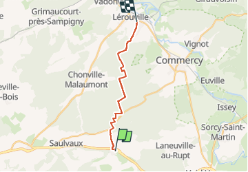
Menil lerouville

Stephanie Champagne
User

Length
13.2 km

Max alt
380 m

Uphill gradient
167 m
Km-Effort
15.7 km

Min alt
232 m

Downhill gradient
256 m
Boucle
No
Creation date :
2024-04-21 16:59:58.396
Updated on :
2024-04-21 17:00:30.207
2h03
Difficulty : Easy

FREE GPS app for hiking
 SityTrail
IGN / Geographical institutes
SityTrail Plus
The world is yours!
About
Trail Horseback riding of 13.2 km to be discovered at Grand Est, Meuse, Ménil-la-Horgne. This trail is proposed by Stephanie Champagne.
Positioning
Country:
France
Region :
Grand Est
Department/Province :
Meuse
Municipality :
Ménil-la-Horgne
Location:
Unknown
Start:(Dec)
Start:(UTM)
685963 ; 5397517 (31U) N.
Comments