


7 sauvelade

thonyc
User GUIDE
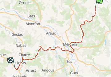

Length
31 km

Max alt
265 m

Uphill gradient
556 m
Km-Effort
39 km

Min alt
98 m

Downhill gradient
543 m
Boucle
No
Creation date :
2024-04-22 06:15:50.693
Updated on :
2024-04-22 15:41:04.756
9h23
Difficulty : Difficult

FREE GPS app for hiking
 SityTrail
IGN / Geographical institutes
SityTrail Plus
The world is yours!
About
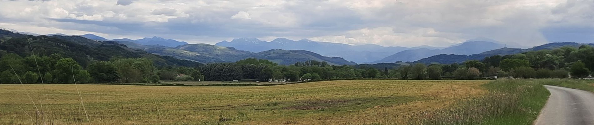
Trail Walking of 31 km to be discovered at New Aquitaine, Pyrénées-Atlantiques, Sauvelade. This trail is proposed by thonyc.
Photos


Positioning
Country:
France
Region :
New Aquitaine
Department/Province :
Pyrénées-Atlantiques
Municipality :
Sauvelade
Location:
Unknown
Start:(Dec)
Start:(UTM)
685691 ; 4807224 (30T) N.
Comments