


apremont petite

Nila81
User

Length
10.4 km

Max alt
372 m

Uphill gradient
224 m
Km-Effort
13.4 km

Min alt
256 m

Downhill gradient
224 m
Boucle
Yes
Creation date :
2024-04-23 08:20:42.771
Updated on :
2024-04-23 08:21:37.362
3h03
Difficulty : Difficult

FREE GPS app for hiking
 SityTrail
IGN / Geographical institutes
SityTrail Plus
The world is yours!
About
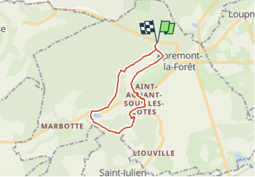
Trail Walking of 10.4 km to be discovered at Grand Est, Meuse, Apremont-la-Forêt. This trail is proposed by Nila81.
Description
via étang de Ronval
Positioning
Country:
France
Region :
Grand Est
Department/Province :
Meuse
Municipality :
Apremont-la-Forêt
Location:
Apremont-la-Forêt
Start:(Dec)
Start:(UTM)
692804 ; 5415338 (31U) N.
Comments