


8 charritte

thonyc
User GUIDE
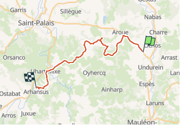

Length
23 km

Max alt
213 m

Uphill gradient
519 m
Km-Effort
30 km

Min alt
80 m

Downhill gradient
518 m
Boucle
No
Creation date :
2024-04-23 06:27:09.364
Updated on :
2024-04-23 13:33:27.615
7h04
Difficulty : Difficult

FREE GPS app for hiking
 SityTrail
IGN / Geographical institutes
SityTrail Plus
The world is yours!
About
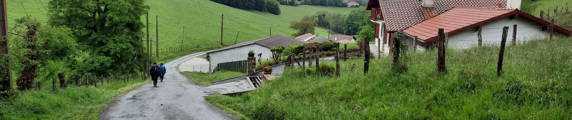
Trail Walking of 23 km to be discovered at New Aquitaine, Pyrénées-Atlantiques, Charritte-de-Bas. This trail is proposed by thonyc.
Photos


Positioning
Country:
France
Region :
New Aquitaine
Department/Province :
Pyrénées-Atlantiques
Municipality :
Charritte-de-Bas
Location:
Unknown
Start:(Dec)
Start:(UTM)
671372 ; 4796038 (30T) N.
Comments