


sabots de Godefroid

thomas1986
User

Length
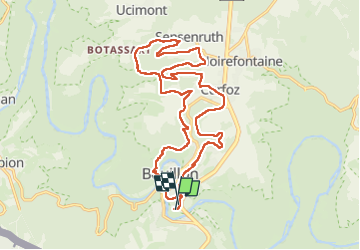
19.8 km

Max alt
394 m

Uphill gradient
628 m
Km-Effort
28 km

Min alt
216 m

Downhill gradient
606 m
Boucle
Yes
Creation date :
2024-05-01 09:05:24.813
Updated on :
2024-05-01 14:11:25.166
4h30
Difficulty : Very difficult

FREE GPS app for hiking
 SityTrail
IGN / Geographical institutes
SityTrail Plus
The world is yours!
About
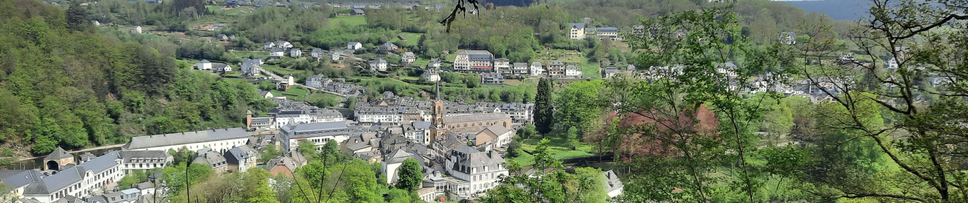
Trail Walking of 19.8 km to be discovered at Wallonia, Luxembourg, Bouillon. This trail is proposed by thomas1986.
Photos


Positioning
Country:
Belgium
Region :
Wallonia
Department/Province :
Luxembourg
Municipality :
Bouillon
Location:
Unknown
Start:(Dec)
Start:(UTM)
648947 ; 5516995 (31U) N.
Comments