


de Gondrecourt

CDSM 55
User

Length
8.8 km

Max alt
433 m

Uphill gradient
154 m
Km-Effort
10.5 km

Min alt
294 m

Downhill gradient
55 m
Boucle
No
Creation date :
2024-05-03 08:52:04.792
Updated on :
2024-05-03 10:51:07.996
1h30
Difficulty : Medium

FREE GPS app for hiking
 SityTrail
IGN / Geographical institutes
SityTrail Plus
The world is yours!
About
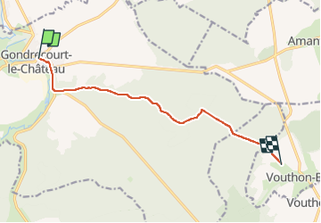
Trail Walking of 8.8 km to be discovered at Grand Est, Meuse, Gondrecourt-le-Château. This trail is proposed by CDSM 55.
Positioning
Country:
France
Region :
Grand Est
Department/Province :
Meuse
Municipality :
Gondrecourt-le-Château
Location:
Unknown
Start:(Dec)
Start:(UTM)
685150 ; 5376392 (31U) N.
Comments
il manque 7 km, mais le réseau n'était pas fameux ce matin,