


Jonchères Pivoines 2024

alinetpierre
User
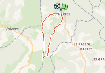

Length
11.9 km

Max alt
1514 m

Uphill gradient
632 m
Km-Effort
20 km

Min alt
893 m

Downhill gradient
643 m
Boucle
Yes
Creation date :
2024-05-03 08:01:03.0
Updated on :
2024-05-03 13:51:42.251

FREE GPS app for hiking
 SityTrail
IGN / Geographical institutes
SityTrail Plus
The world is yours!
About
Trail of 11.9 km to be discovered at Auvergne-Rhône-Alpes, Drôme, Jonchères. This trail is proposed by alinetpierre.
Description
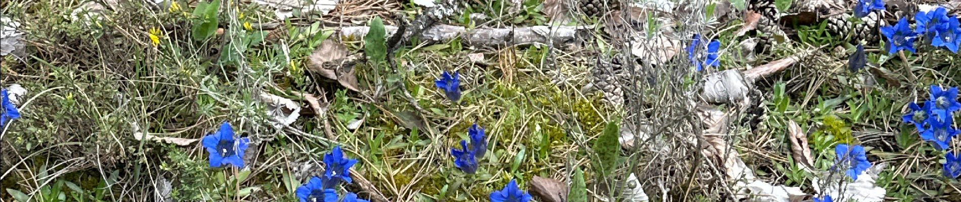
Belle randonnée à faire en mai pour admirer les pivoines sauvages
Photos


Positioning
Country:
France
Region :
Auvergne-Rhône-Alpes
Department/Province :
Drôme
Municipality :
Jonchères
Location:
Unknown
Start:(Dec)
Start:(UTM)
690806 ; 4938198 (31T) N.
Comments