


déco des Monts

whisper73
User
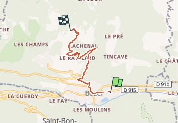

Length
5.4 km

Max alt
1544 m

Uphill gradient
687 m
Km-Effort
12.3 km

Min alt
849 m

Downhill gradient
0 m
Boucle
No
Creation date :
2024-05-04 06:18:34.143
Updated on :
2024-05-04 07:56:48.081
1h37
Difficulty : Difficult
10m
Difficulty : Very easy

FREE GPS app for hiking
 SityTrail
IGN / Geographical institutes
SityTrail Plus
The world is yours!
About
Trail Walking of 5.4 km to be discovered at Auvergne-Rhône-Alpes, Savoy, Bozel. This trail is proposed by whisper73.
Positioning
Country:
France
Region :
Auvergne-Rhône-Alpes
Department/Province :
Savoy
Municipality :
Bozel
Location:
Unknown
Start:(Dec)
Start:(UTM)
316598 ; 5034816 (32T) N.
Comments