


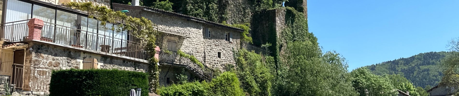
Lamastre Desaignes

alinetpierre
User
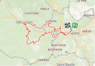

Length
21 km

Max alt
704 m

Uphill gradient
596 m
Km-Effort
29 km

Min alt
371 m

Downhill gradient
596 m
Boucle
Yes
Creation date :
2024-05-09 06:51:45.0
Updated on :
2024-05-09 13:35:59.52

FREE GPS app for hiking
 SityTrail
IGN / Geographical institutes
SityTrail Plus
The world is yours!
About
Trail of 21 km to be discovered at Auvergne-Rhône-Alpes, Ardèche, Lamastre. This trail is proposed by alinetpierre.
Photos


Positioning
Country:
France
Region :
Auvergne-Rhône-Alpes
Department/Province :
Ardèche
Municipality :
Lamastre
Location:
Unknown
Start:(Dec)
Start:(UTM)
624446 ; 4982740 (31T) N.
Comments