Trail Road bike Mauriac - Neuvic d'Ussel - Photo
© OpenStreetMap contributors
Length
Length
62 km
Max alt
Max alt
712 m
Uphill gradient
Uphill gradient
1137 m
Km-Effort
Km-Effort  
77 km
Min alt
Min alt
317 m
Downhill gradient
Downhill gradient
1138 m
Boucle
Boucle
Yes
Creation date :
2024-05-10 11:32:01.822
Updated on :
2024-05-10 15:04:55.731

(0 Reviews)

Road bike
Road bike
3h12
Difficulty : Medium

Scan this QR Code to open this trail in the SityTrail application

FREE GPS app for hiking

Logo SityTrail SityTrail

IGN / Geographical institutes

Download SityTrail from the App Store Download SityTrail from Google Play

Logo SityTrail SityTrail World

The world is yours!

Download SityTrail from the App Store Download SityTrail from Google Play Download SityTrail on Huawei AppGallery

About

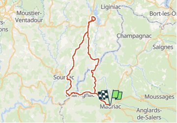
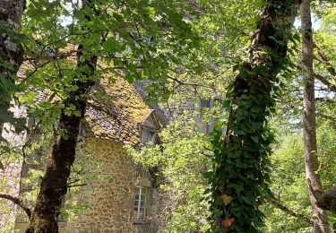
Trail Road bike of 62 km to be discovered at Auvergne-Rhône-Alpes, Cantal, Mauriac. This trail is proposed by Jean-Marie Bousquet.

Description

boucle au départ de Mauriac. Neuvic via pont de St Projet sur la Dordogne
Retour via le barrage de l'Aigle.

Elevation profile

Positioning

Country:
France
Region :
Auvergne-Rhône-Alpes
Department/Province :
Cantal
Municipality :
Mauriac
Location:
Unknown
Start:(UTM)
447594 ; 5007476 (31T) N.

Trails nearby

Trail Cycle Brageac - velo20180820 - Photo
Cycle
robertserre

Cycle

Very easy
Brageac, Auvergne-Rhône-Alpes, Cantal, France
40 km | 53 km-effort
2h 49min
Yes
Trail Other activity Escorailles - 16.8.2013 - Photo
Other activity
robertserre

Other activity

Medium
Escorailles, Auvergne-Rhône-Alpes, Cantal, France
7.3 km | 10.4 km-effort
2h 49min
Yes
Trail Walking Escorailles - la trizague - Photo
Walking
robertserre

Walking

Very easy
Escorailles, Auvergne-Rhône-Alpes, Cantal, France
4.2 km | 6.5 km-effort
1h 31min
No
Trail Walking Salins - Rando cascade Salins - Photo
Walking
tiki01

Walking

Easy
Salins, Auvergne-Rhône-Alpes, Cantal, France
3.5 km | 5 km-effort
1h 10min
Yes
Trail Walking Chalvignac - Le Fanc - Photo
Walking
Eric Gerrier

Walking

Easy
Chalvignac, Auvergne-Rhône-Alpes, Cantal, France
3.5 km | 3.8 km-effort
1h 0min
Yes
Trail Walking Le Vigean - 20210616 Chambres  - Photo
Walking
Childebert

Walking

Medium
(1)
Le Vigean, Auvergne-Rhône-Alpes, Cantal, France
6.4 km | 8.3 km-effort
3h 12min
Yes
Trail Walking Le Vigean - Le Vigean - Photo
Walking
Eric Gerrier

Walking

Difficult
Le Vigean, Auvergne-Rhône-Alpes, Cantal, France
15 km | 17.2 km-effort
1h 30min
No
Trail Walking Escorailles - 06.08.2013 - Photo
Walking
robertserre

Walking

Very easy
Escorailles, Auvergne-Rhône-Alpes, Cantal, France
4.3 km | 6.5 km-effort
1h 58min
No
Trail Walking Mauriac - Rando fête de la pompe - Photo
Walking
tiki01

Walking

Medium
Mauriac, Auvergne-Rhône-Alpes, Cantal, France
8 km | 10.4 km-effort
1h 48min
Yes


Close
My subscriptions