


À la découverte des sources des eaux thermales de la Dordogne

micheldutilleul
User

Length
5.9 km

Max alt
1083 m

Uphill gradient
213 m
Km-Effort
8.7 km

Min alt
890 m

Downhill gradient
214 m
Boucle
Yes
Creation date :
2024-05-10 12:06:36.196
Updated on :
2024-05-10 15:12:28.3
1h26
Difficulty : Easy

FREE GPS app for hiking
 SityTrail
IGN / Geographical institutes
SityTrail Plus
The world is yours!
About
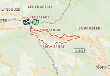
Trail Walking of 5.9 km to be discovered at Auvergne-Rhône-Alpes, Puy-de-Dôme, Mont-Dore. This trail is proposed by micheldutilleul.
Positioning
Country:
France
Region :
Auvergne-Rhône-Alpes
Department/Province :
Puy-de-Dôme
Municipality :
Mont-Dore
Location:
Unknown
Start:(Dec)
Start:(UTM)
481835 ; 5048529 (31T) N.
Comments