


lareid . vertbuisson . haut marais . fraineux . la reid

stef789
User GUIDE
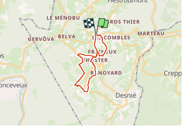

Length
9.6 km

Max alt
420 m

Uphill gradient
163 m
Km-Effort
11.8 km

Min alt
290 m

Downhill gradient
163 m
Boucle
Yes
Creation date :
2024-05-13 10:18:57.799
Updated on :
2024-05-13 12:58:04.128
2h38
Difficulty : Medium

FREE GPS app for hiking
 SityTrail
IGN / Geographical institutes
SityTrail Plus
The world is yours!
About
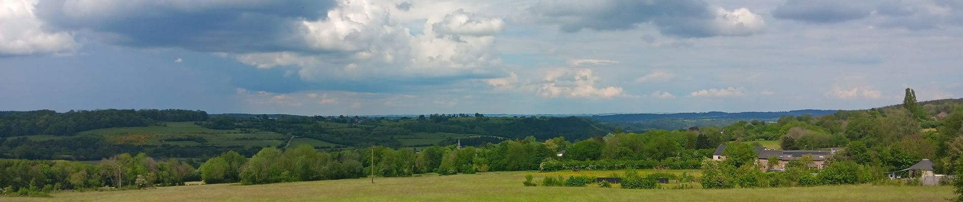
Trail Walking of 9.6 km to be discovered at Wallonia, Liège, Theux. This trail is proposed by stef789.
Photos


Positioning
Country:
Belgium
Region :
Wallonia
Department/Province :
Liège
Municipality :
Theux
Location:
Unknown
Start:(Dec)
Start:(UTM)
697957 ; 5596669 (31U) N.
Comments
Merci pour ces belles photos. Ajouté à mon agenda ;-)