


ST NICOLAS D'ALIERMONT

juanluco76
User
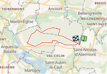

Length
11.3 km

Max alt
145 m

Uphill gradient
137 m
Km-Effort
13.1 km

Min alt
62 m

Downhill gradient
136 m
Boucle
Yes
Creation date :
2024-05-14 17:58:08.018
Updated on :
2024-05-14 17:58:51.395
2h58
Difficulty : Difficult

FREE GPS app for hiking
 SityTrail
IGN / Geographical institutes
SityTrail Plus
The world is yours!
About
Trail Walking of 11.3 km to be discovered at Normandy, Seine-Maritime, Saint-Nicolas-d'Aliermont. This trail is proposed by juanluco76.
Positioning
Country:
France
Region :
Normandy
Department/Province :
Seine-Maritime
Municipality :
Saint-Nicolas-d'Aliermont
Location:
Unknown
Start:(Dec)
Start:(UTM)
371225 ; 5527217 (31U) N.
Comments