


Chateaugay

Gegetop
User

Length
11 km

Max alt
511 m

Uphill gradient
208 m
Km-Effort
13.8 km

Min alt
394 m

Downhill gradient
207 m
Boucle
Yes
Creation date :
2015-04-13 00:00:00.0
Updated on :
2015-04-13 00:00:00.0
2h30
Difficulty : Easy

FREE GPS app for hiking
 SityTrail
IGN / Geographical institutes
SityTrail Plus
The world is yours!
About
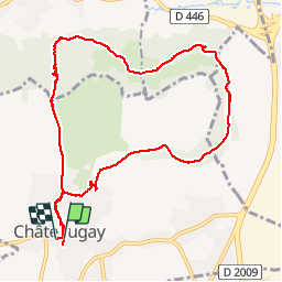
Trail Walking of 11 km to be discovered at Auvergne-Rhône-Alpes, Puy-de-Dôme, Châteaugay. This trail is proposed by Gegetop.
Description
Balade sympa qui nous fait découvrir un point de vue remarquable sur Ménétrol et Riom en passant par le Parc Mirabel.
Positioning
Country:
France
Region :
Auvergne-Rhône-Alpes
Department/Province :
Puy-de-Dôme
Municipality :
Châteaugay
Location:
Unknown
Start:(Dec)
Start:(UTM)
506669 ; 5077320 (31T) N.
Comments