


mont bochor

whisper73
User

Length
4.7 km

Max alt
2204 m

Uphill gradient
778 m
Km-Effort
12.5 km

Min alt
1424 m

Downhill gradient
3 m
Boucle
No
Creation date :
2024-05-19 06:32:57.094
Updated on :
2024-05-19 08:07:09.554
1h33
Difficulty : Difficult
15m
Difficulty : Very easy

FREE GPS app for hiking
 SityTrail
IGN / Geographical institutes
SityTrail Plus
The world is yours!
About
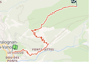
Trail Walking of 4.7 km to be discovered at Auvergne-Rhône-Alpes, Savoy, Pralognan-la-Vanoise. This trail is proposed by whisper73.
Positioning
Country:
France
Region :
Auvergne-Rhône-Alpes
Department/Province :
Savoy
Municipality :
Pralognan-la-Vanoise
Location:
Unknown
Start:(Dec)
Start:(UTM)
321716 ; 5027665 (32T) N.
Comments