


la Guardiole

Ninie38MD
User
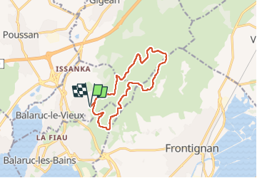

Length
13.2 km

Max alt
226 m

Uphill gradient
237 m
Km-Effort
16.4 km

Min alt
55 m

Downhill gradient
238 m
Boucle
Yes
Creation date :
2024-05-22 07:49:38.47
Updated on :
2024-05-22 12:10:31.358
4h20
Difficulty : Medium

FREE GPS app for hiking
 SityTrail
IGN / Geographical institutes
SityTrail Plus
The world is yours!
About
Trail Nordic walking of 13.2 km to be discovered at Occitania, Hérault, Balaruc-le-Vieux. This trail is proposed by Ninie38MD.
Description
boucle
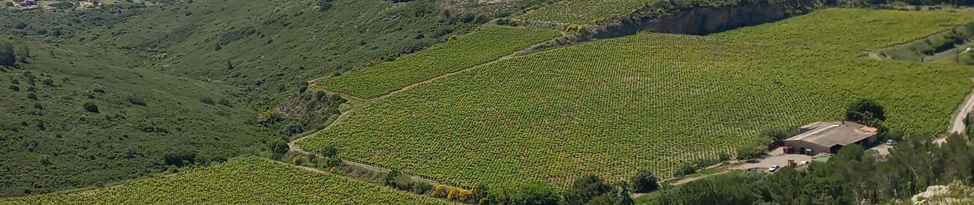
Photos


Positioning
Country:
France
Region :
Occitania
Department/Province :
Hérault
Municipality :
Balaruc-le-Vieux
Location:
Unknown
Start:(Dec)
Start:(UTM)
556956 ; 4812496 (31T) N.
Comments