


Arz

bourdet
User

Length
9.2 km

Max alt
17 m

Uphill gradient
58 m
Km-Effort
9.9 km

Min alt
-1 m

Downhill gradient
58 m
Boucle
Yes
Creation date :
2024-05-22 12:00:47.054
Updated on :
2024-05-22 14:44:52.242
2h41
Difficulty : Medium

FREE GPS app for hiking
 SityTrail
IGN / Geographical institutes
SityTrail Plus
The world is yours!
About
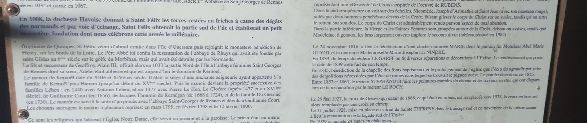
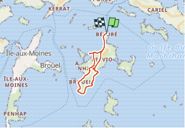
Trail Walking of 9.2 km to be discovered at Brittany, Morbihan, Île-d'Arz. This trail is proposed by bourdet.
Photos


Positioning
Country:
France
Region :
Brittany
Department/Province :
Morbihan
Municipality :
Île-d'Arz
Location:
Unknown
Start:(Dec)
Start:(UTM)
515511 ; 5272484 (30T) N.
Comments