


Les Arcs Menhirs et Dolmen

Pascal-83
User
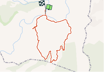

Length
10 km
Boucle
No
Creation date :
2024-05-23 06:42:26.204
Updated on :
2024-05-23 10:17:35.933
3h34
Difficulty : Medium

FREE GPS app for hiking
 SityTrail
IGN / Geographical institutes
SityTrail Plus
The world is yours!
About
Trail Walking of 10 km to be discovered at Provence-Alpes-Côte d'Azur, Var, Les Arcs-sur-Argens. This trail is proposed by Pascal-83.
Description
Grande marche Roquebrune Amitié
Photos


Positioning
Country:
France
Region :
Provence-Alpes-Côte d'Azur
Department/Province :
Var
Municipality :
Les Arcs-sur-Argens
Location:
Unknown
Start:(Dec)
Start:(UTM)
298484 ; 4811859 (32T) N.
Comments