


D400 (351-400)

yannick-p
User
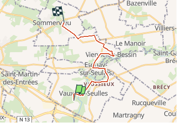

Length
9.1 km

Max alt
57 m

Uphill gradient
90 m
Km-Effort
10.3 km

Min alt
22 m

Downhill gradient
79 m
Boucle
No
Creation date :
2015-04-13 00:00:00.0
Updated on :
2015-04-13 00:00:00.0
1h00
Difficulty : Easy

FREE GPS app for hiking
 SityTrail
IGN / Geographical institutes
SityTrail Plus
The world is yours!
About
Trail Walking of 9.1 km to be discovered at Normandy, Calvados, Vaux-sur-Seulles. This trail is proposed by yannick-p.
Description
Extrait Parcours D400 Team
Positioning
Country:
France
Region :
Normandy
Department/Province :
Calvados
Municipality :
Vaux-sur-Seulles
Location:
Unknown
Start:(Dec)
Start:(UTM)
672073 ; 5458839 (30U) N.
Comments