


Col des Glieres N D des Neiges

COMAN
User
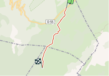

Length
3.3 km

Max alt
1457 m

Uphill gradient
95 m
Km-Effort
4.5 km

Min alt
1377 m

Downhill gradient
75 m
Boucle
No
Creation date :
2015-04-13 00:00:00.0
Updated on :
2015-04-13 00:00:00.0
1h01
Difficulty : Easy

FREE GPS app for hiking
 SityTrail
IGN / Geographical institutes
SityTrail Plus
The world is yours!
About
Trail Walking of 3.3 km to be discovered at Auvergne-Rhône-Alpes, Upper Savoy, Fillière. This trail is proposed by COMAN.
Positioning
Country:
France
Region :
Auvergne-Rhône-Alpes
Department/Province :
Upper Savoy
Municipality :
Fillière
Location:
Thorens-Glières
Start:(Dec)
Start:(UTM)
292861 ; 5093455 (32T) N.
Comments