


Circuit de l'eau

Pascal-83
User
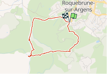

Length
4.3 km

Max alt
94 m

Uphill gradient
114 m
Km-Effort
5.9 km

Min alt
22 m

Downhill gradient
118 m
Boucle
Yes
Creation date :
2024-06-01 06:26:16.878
Updated on :
2024-06-01 18:07:01.16
1h19
Difficulty : Easy

FREE GPS app for hiking
 SityTrail
IGN / Geographical institutes
SityTrail Plus
The world is yours!
About
Trail Walking of 4.3 km to be discovered at Provence-Alpes-Côte d'Azur, Var, Roquebrune-sur-Argens. This trail is proposed by Pascal-83.
Description
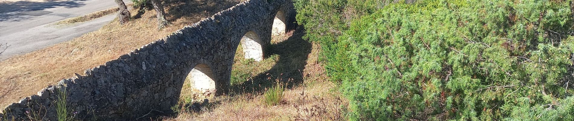
25 Ponts et Moulins de La Maurette Roquebrune sur Argens
Photos


Positioning
Country:
France
Region :
Provence-Alpes-Côte d'Azur
Department/Province :
Var
Municipality :
Roquebrune-sur-Argens
Location:
Unknown
Start:(Dec)
Start:(UTM)
308515 ; 4812379 (32T) N.
Comments