


Liausson Moureze Liausson

alinetpierre
User
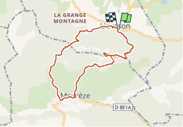

Length
9.3 km

Max alt
509 m

Uphill gradient
450 m
Km-Effort
15.3 km

Min alt
215 m

Downhill gradient
448 m
Boucle
Yes
Creation date :
2024-06-02 08:17:49.0
Updated on :
2024-06-02 12:27:21.995

FREE GPS app for hiking
 SityTrail
IGN / Geographical institutes
SityTrail Plus
The world is yours!
About
Trail of 9.3 km to be discovered at Occitania, Hérault, Liausson. This trail is proposed by alinetpierre.
Description
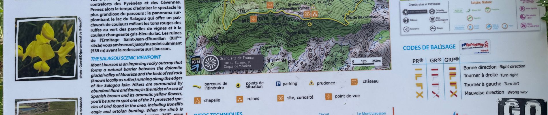
Très belle randonnée possibilité de prendre le pr pour rejoindre le col de porte dans le village de Moureze
Photos


Positioning
Country:
France
Region :
Occitania
Department/Province :
Hérault
Municipality :
Liausson
Location:
Unknown
Start:(Dec)
Start:(UTM)
529946 ; 4831430 (31T) N.
Comments