


la coche, les serrons

okfred26
User
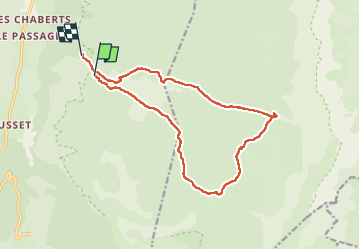

Length
16 km

Max alt
1690 m

Uphill gradient
338 m
Km-Effort
21 km

Min alt
1359 m

Downhill gradient
356 m
Boucle
No
Creation date :
2024-06-02 07:28:38.663
Updated on :
2024-06-03 06:58:26.157
6h16
Difficulty : Very difficult

FREE GPS app for hiking
 SityTrail
IGN / Geographical institutes
SityTrail Plus
The world is yours!
About
Trail Walking of 16 km to be discovered at Auvergne-Rhône-Alpes, Drôme, Saint-Agnan-en-Vercors. This trail is proposed by okfred26.
Positioning
Country:
France
Region :
Auvergne-Rhône-Alpes
Department/Province :
Drôme
Municipality :
Saint-Agnan-en-Vercors
Location:
Unknown
Start:(Dec)
Start:(UTM)
693200 ; 4972671 (31T) N.
Comments