


240606 - Taulignon

randodan
User
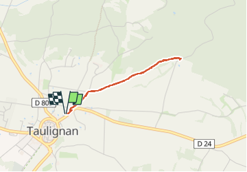

Length
2.8 km

Max alt
334 m

Uphill gradient
55 m
Km-Effort
3.5 km

Min alt
278 m

Downhill gradient
55 m
Boucle
Yes
Creation date :
2024-06-06 08:31:12.423
Updated on :
2024-06-06 09:33:39.921
1h02
Difficulty : Very easy

FREE GPS app for hiking
 SityTrail
IGN / Geographical institutes
SityTrail Plus
The world is yours!
About
Trail Walking of 2.8 km to be discovered at Auvergne-Rhône-Alpes, Drôme, Taulignan. This trail is proposed by randodan.
Positioning
Country:
France
Region :
Auvergne-Rhône-Alpes
Department/Province :
Drôme
Municipality :
Taulignan
Location:
Unknown
Start:(Dec)
Start:(UTM)
657767 ; 4923222 (31T) N.
Comments