


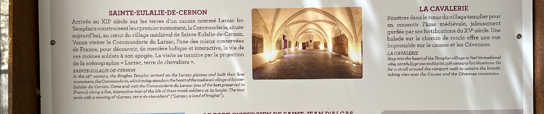
Sté Eulalie du Cernon, La Cavalerie

alinetpierre
User
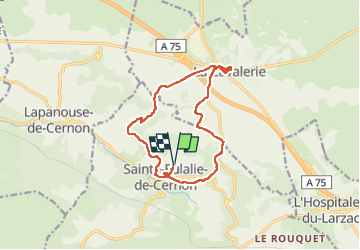

Length
14.3 km

Max alt
845 m

Uphill gradient
378 m
Km-Effort
19.3 km

Min alt
576 m

Downhill gradient
379 m
Boucle
Yes
Creation date :
2024-06-08 06:24:10.0
Updated on :
2024-06-08 11:21:07.161

FREE GPS app for hiking
 SityTrail
IGN / Geographical institutes
SityTrail Plus
The world is yours!
About
Trail of 14.3 km to be discovered at Occitania, Aveyron, Sainte-Eulalie-de-Cernon. This trail is proposed by alinetpierre.
Description
Belle randonnée Villages Templiers exceptionnels .
À l’arrivée attention au sentier qui était un peu abandonner , peut être prendre la route
Photos


Positioning
Country:
France
Region :
Occitania
Department/Province :
Aveyron
Municipality :
Sainte-Eulalie-de-Cernon
Location:
Unknown
Start:(Dec)
Start:(UTM)
511097 ; 4870221 (31T) N.
Comments