


P

raygautier
User
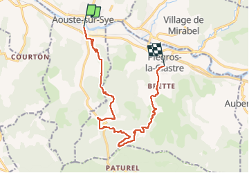

Length
14.4 km

Max alt
709 m

Uphill gradient
691 m
Km-Effort
23 km

Min alt
203 m

Downhill gradient
662 m
Boucle
No
Creation date :
2024-06-09 05:17:01.0
Updated on :
2024-06-09 09:46:28.472

FREE GPS app for hiking
 SityTrail
IGN / Geographical institutes
SityTrail Plus
The world is yours!
About
Trail of 14.4 km to be discovered at Auvergne-Rhône-Alpes, Drôme, Aouste-sur-Sye. This trail is proposed by raygautier.
Positioning
Country:
France
Region :
Auvergne-Rhône-Alpes
Department/Province :
Drôme
Municipality :
Aouste-sur-Sye
Location:
Unknown
Start:(Dec)
Start:(UTM)
662956 ; 4953134 (31T) N.
Comments