


2024 06 09 Montrichard

chlafaille
User

Length
14.5 km

Max alt
141 m

Uphill gradient
214 m
Km-Effort
17.4 km

Min alt
57 m

Downhill gradient
213 m
Boucle
Yes
Creation date :
2024-06-09 10:51:43.091
Updated on :
2024-06-09 14:08:58.954
3h16
Difficulty : Medium

FREE GPS app for hiking
 SityTrail
IGN / Geographical institutes
SityTrail Plus
The world is yours!
About
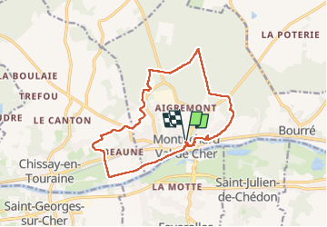
Trail Walking of 14.5 km to be discovered at Centre-Loire Valley, Loir-et-Cher, Montrichard Val de Cher. This trail is proposed by chlafaille.
Positioning
Country:
France
Region :
Centre-Loire Valley
Department/Province :
Loir-et-Cher
Municipality :
Montrichard Val de Cher
Location:
Unknown
Start:(Dec)
Start:(UTM)
362862 ; 5245066 (31T) N.
Comments