


Soulagese Chateau du ousquet

avdem
User
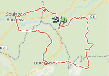

Length
15.2 km

Max alt
970 m

Uphill gradient
348 m
Km-Effort
19.8 km

Min alt
849 m

Downhill gradient
347 m
Boucle
Yes
Creation date :
2024-06-10 07:39:31.685
Updated on :
2024-06-10 13:30:07.94
5h48
Difficulty : Easy

FREE GPS app for hiking
 SityTrail
IGN / Geographical institutes
SityTrail Plus
The world is yours!
About
Trail Walking of 15.2 km to be discovered at Occitania, Aveyron, Laguiole. This trail is proposed by avdem.
Description
facile interessant
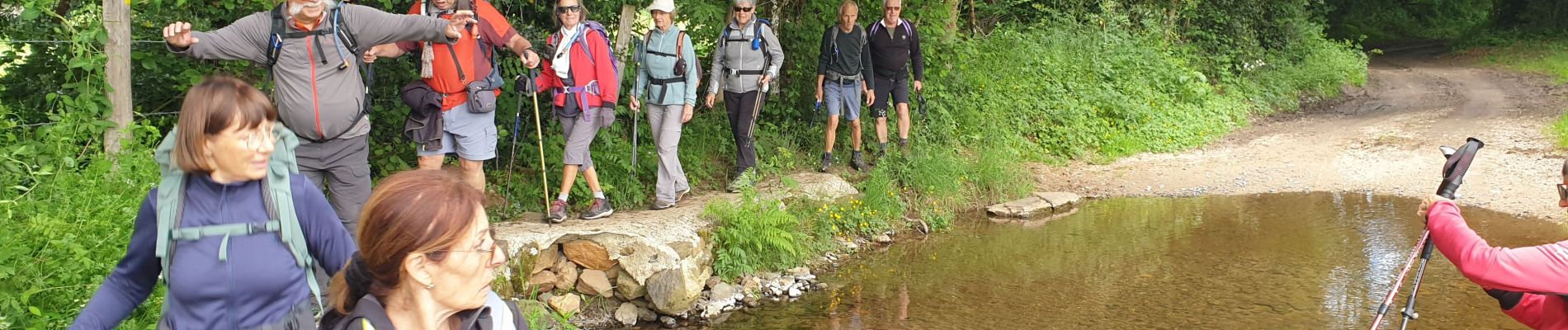
Photos


Positioning
Country:
France
Region :
Occitania
Department/Province :
Aveyron
Municipality :
Laguiole
Location:
Unknown
Start:(Dec)
Start:(UTM)
485424 ; 4946508 (31T) N.
Comments