


visorando-53598745

doudet
User
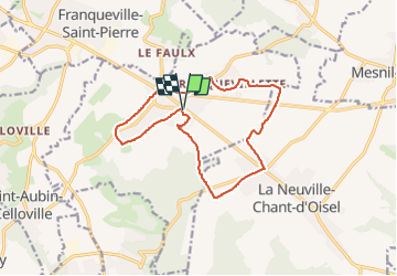

Length
13.2 km

Max alt
162 m

Uphill gradient
99 m
Km-Effort
14.5 km

Min alt
140 m

Downhill gradient
99 m
Boucle
Yes
Creation date :
2024-06-12 07:31:01.693
Updated on :
2024-06-12 07:33:38.215
3h17
Difficulty : Difficult

FREE GPS app for hiking
 SityTrail
IGN / Geographical institutes
SityTrail Plus
The world is yours!
About
Trail Walking of 13.2 km to be discovered at Normandy, Seine-Maritime, Boos. This trail is proposed by doudet.
Positioning
Country:
France
Region :
Normandy
Department/Province :
Seine-Maritime
Municipality :
Boos
Location:
Unknown
Start:(Dec)
Start:(UTM)
369978 ; 5471796 (31U) N.
Comments