


Le punch de montarki

avdem
User

Length
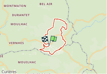
14 km

Max alt
1339 m

Uphill gradient
275 m
Km-Effort
17.7 km

Min alt
1179 m

Downhill gradient
278 m
Boucle
Yes
Creation date :
2024-06-12 07:22:50.886
Updated on :
2024-06-12 12:51:48.848
5h27
Difficulty : Easy

FREE GPS app for hiking
 SityTrail
IGN / Geographical institutes
SityTrail Plus
The world is yours!
About
Trail Walking of 14 km to be discovered at Occitania, Aveyron, Laguiole. This trail is proposed by avdem.
Description
facile
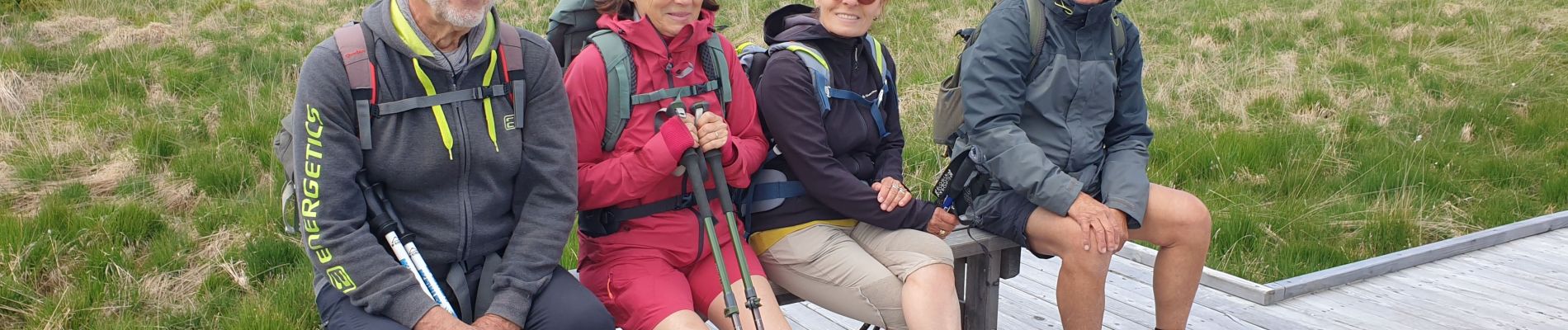
Photos

Positioning
Country:
France
Region :
Occitania
Department/Province :
Aveyron
Municipality :
Laguiole
Location:
Unknown
Start:(Dec)
Start:(UTM)
493043 ; 4946793 (31T) N.
Comments