


desb

brandy
User
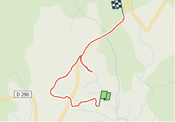

Length
3.2 km

Max alt
283 m

Uphill gradient
60 m
Km-Effort
4 km

Min alt
238 m

Downhill gradient
51 m
Boucle
No
Creation date :
2024-06-20 16:53:12.565
Updated on :
2024-06-20 17:56:44.844
49m
Difficulty : Easy

FREE GPS app for hiking
 SityTrail
IGN / Geographical institutes
SityTrail Plus
The world is yours!
About
Trail Walking of 3.2 km to be discovered at Auvergne-Rhône-Alpes, Ardèche, Bidon. This trail is proposed by brandy.
Positioning
Country:
France
Region :
Auvergne-Rhône-Alpes
Department/Province :
Ardèche
Municipality :
Bidon
Location:
Unknown
Start:(Dec)
Start:(UTM)
623445 ; 4910774 (31T) N.
Comments