


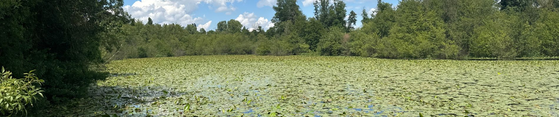
Étang du Mouchet , Chavannes, Chantemerle les Blés

alinetpierre
User
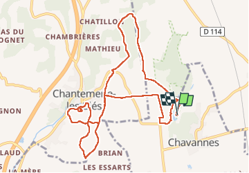

Length
12.4 km

Max alt
290 m

Uphill gradient
249 m
Km-Effort
15.7 km

Min alt
192 m

Downhill gradient
249 m
Boucle
Yes
Creation date :
2024-06-22 09:55:58.0
Updated on :
2024-06-22 13:21:57.633

FREE GPS app for hiking
 SityTrail
IGN / Geographical institutes
SityTrail Plus
The world is yours!
About
Trail of 12.4 km to be discovered at Auvergne-Rhône-Alpes, Drôme, Chavannes. This trail is proposed by alinetpierre.
Description
Boucles entre Chavannes , l’Etang du Mouchet et Chantemerle les Blés.
En juin 2024
Photos


Positioning
Country:
France
Region :
Auvergne-Rhône-Alpes
Department/Province :
Drôme
Municipality :
Chavannes
Location:
Unknown
Start:(Dec)
Start:(UTM)
651138 ; 4996882 (31T) N.
Comments