


MT Brouilly .St Lager

janussity
User
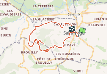

Length
9.4 km

Max alt
482 m

Uphill gradient
271 m
Km-Effort
13 km

Min alt
229 m

Downhill gradient
269 m
Boucle
Yes
Creation date :
2024-06-22 08:47:06.667
Updated on :
2024-06-22 13:52:25.856
2h45
Difficulty : Medium

FREE GPS app for hiking
 SityTrail
IGN / Geographical institutes
SityTrail Plus
The world is yours!
About
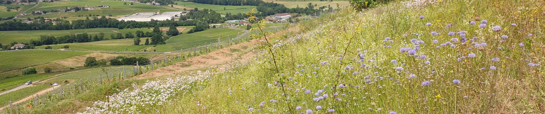
Trail Walking of 9.4 km to be discovered at Auvergne-Rhône-Alpes, Rhône, Saint-Lager. This trail is proposed by janussity.
Description
frais soleil petite rincée
Photos


Positioning
Country:
France
Region :
Auvergne-Rhône-Alpes
Department/Province :
Rhône
Municipality :
Saint-Lager
Location:
Unknown
Start:(Dec)
Start:(UTM)
629409 ; 5107650 (31T) N.
Comments