


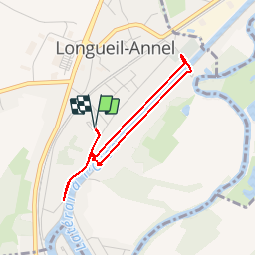
Longueil-Annel_Le canal et l'écluse_3,1km

Pousscailleux
User


43m
Difficulty : Easy

FREE GPS app for hiking
 SityTrail
IGN / Geographical institutes
SityTrail Plus
The world is yours!
About
Trail Walking of 3.1 km to be discovered at Hauts-de-France, Oise, Longueil-Annel. This trail is proposed by Pousscailleux.
Description
Départ du parking de la Cité des Bateliers.
Promenade le long des berges du canal, jalonnées par 5 kiosques sonores sur les lieux et activités de la batellerie. Une promenade bucolique où sont rappelés les 10 commandements des mariniers sur les 10 bornes jalonnant le circuit et où nous découvrirons le fonctionnement d'une écluse grandeur nature !
Positioning
Comments