


morzine la cime de Nyon

labarone
User
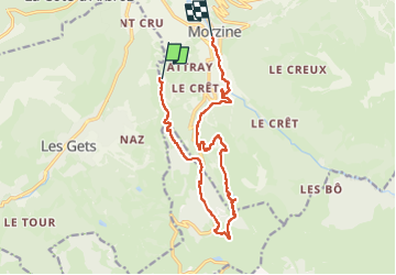

Length
14.6 km

Max alt
1634 m

Uphill gradient
408 m
Km-Effort
22 km

Min alt
961 m

Downhill gradient
942 m
Boucle
No
Creation date :
2024-06-24 07:11:11.151
Updated on :
2024-06-24 13:17:37.076
5h59
Difficulty : Difficult

FREE GPS app for hiking
 SityTrail
IGN / Geographical institutes
SityTrail Plus
The world is yours!
About
Trail Walking of 14.6 km to be discovered at Auvergne-Rhône-Alpes, Upper Savoy, Morzine. This trail is proposed by labarone.
Description
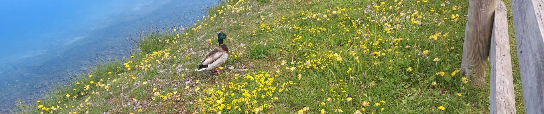
magnifique paysage
beau troupeau de vaches au lac et belle cascade sur le retour
Photos


Positioning
Country:
France
Region :
Auvergne-Rhône-Alpes
Department/Province :
Upper Savoy
Municipality :
Morzine
Location:
Unknown
Start:(Dec)
Start:(UTM)
321894 ; 5115471 (32T) N.
Comments