


Rennersteig

patign
User

Length
10.3 km

Max alt
486 m

Uphill gradient
281 m
Km-Effort
14.5 km

Min alt
199 m

Downhill gradient
424 m
Boucle
No
Creation date :
2024-06-24 12:39:27.0
Updated on :
2024-06-24 17:37:04.978
2h34
Difficulty : Unknown

FREE GPS app for hiking
 SityTrail
IGN / Geographical institutes
SityTrail Plus
The world is yours!
About
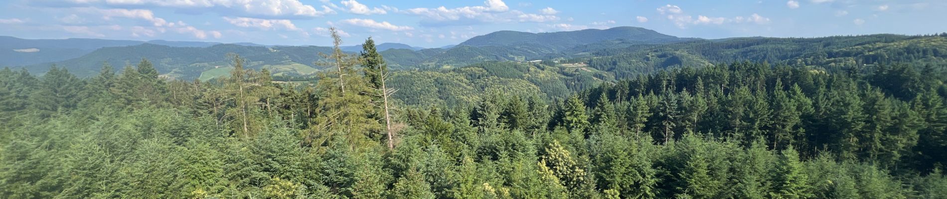
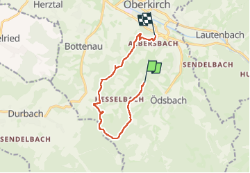
Trail Walking of 10.3 km to be discovered at Baden-Württemberg, Ortenaukreis, Oberkirch. This trail is proposed by patign.
Photos


Positioning
Country:
Germany
Region :
Baden-Württemberg
Department/Province :
Ortenaukreis
Municipality :
Oberkirch
Location:
Unknown
Start:(Dec)
Start:(UTM)
431851 ; 5372818 (32U) N.
Comments