


4×4_220624_PM

d.rognon
User
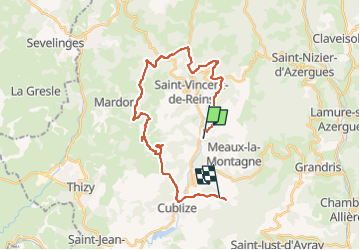

Length
28 km

Max alt
811 m

Uphill gradient
1230 m
Km-Effort
44 km

Min alt
451 m

Downhill gradient
1054 m
Boucle
No
Creation date :
2024-06-22 12:26:22.175
Updated on :
2024-06-25 18:35:28.011
3h07
Difficulty : Very easy

FREE GPS app for hiking
 SityTrail
IGN / Geographical institutes
SityTrail Plus
The world is yours!
About
Trail 4x4 of 28 km to be discovered at Auvergne-Rhône-Alpes, Rhône, Meaux-la-Montagne. This trail is proposed by d.rognon.
Positioning
Country:
France
Region :
Auvergne-Rhône-Alpes
Department/Province :
Rhône
Municipality :
Meaux-la-Montagne
Location:
Unknown
Start:(Dec)
Start:(UTM)
608076 ; 5100776 (31T) N.
Comments