


Barrage pradeaux Meyderolles reco

terrano
User

Length
41 km

Max alt
1342 m

Uphill gradient
1194 m
Km-Effort
58 km

Min alt
781 m

Downhill gradient
1482 m
Boucle
No
Creation date :
2024-06-29 13:15:22.222
Updated on :
2024-06-29 16:44:15.613
3h27
Difficulty : Very easy

FREE GPS app for hiking
 SityTrail
IGN / Geographical institutes
SityTrail Plus
The world is yours!
About
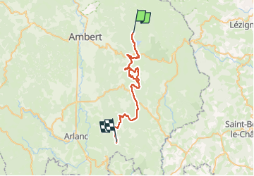
Trail 4x4 of 41 km to be discovered at Auvergne-Rhône-Alpes, Puy-de-Dôme, Valcivières. This trail is proposed by terrano.
Positioning
Country:
France
Region :
Auvergne-Rhône-Alpes
Department/Province :
Puy-de-Dôme
Municipality :
Valcivières
Location:
Unknown
Start:(Dec)
Start:(UTM)
565289 ; 5044966 (31T) N.
Comments